Climate forecasting tools that harness AI and satellite data can transform your farm management. They combine real-time satellite imagery with AI algorithms to deliver precise weather forecasts and analyze historical climate patterns. This helps you plan planting, irrigation, and harvesting more effectively, anticipate pest outbreaks, and select suitable crops. These tools also monitor soil moisture and resource use, making your farm more resilient. Keep exploring to discover how these advanced technologies can become essential assets for your farming success.
Key Takeaways
- Integrate AI algorithms with satellite imagery for precise, real-time weather and climate predictions tailored to farming needs.
- Use satellite data to monitor soil moisture and identify drought or flood zones, optimizing resource allocation.
- Employ AI-driven pest prediction models to enable early interventions and reduce chemical usage.
- Leverage climate forecasts to inform crop selection, planting schedules, and adaptive strategies for varying environmental conditions.
- Enhance farm management by combining historical and real-time data to improve decision-making and increase crop yields.
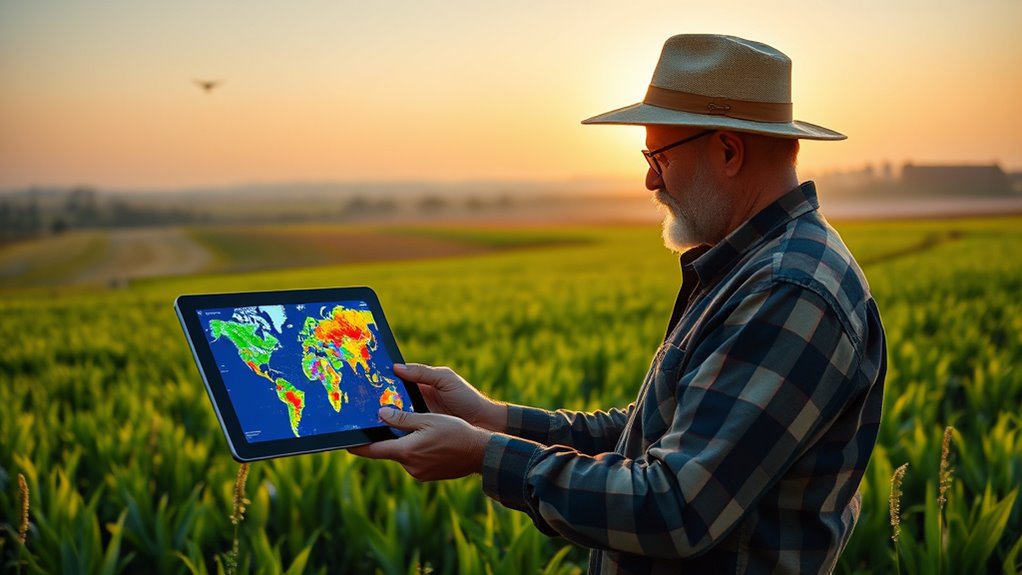
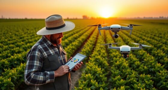
Climate forecasting tools are revolutionizing how farmers plan and manage their crops. With the integration of AI and satellite data, you now have access to precise weather predictions that can substantially impact your farm’s productivity. These tools help you anticipate how weather patterns will influence your crop yield, allowing you to make informed decisions about planting, irrigation, and harvesting schedules. By analyzing historical climate data alongside real-time satellite imagery, you can identify trends and prepare your fields for upcoming conditions, reducing the risk of crop failure and maximizing your harvest potential.
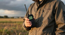
One of the most valuable benefits of these advanced climate forecasting systems is their ability to improve pest prediction. Pests often thrive under specific weather conditions, and early warnings about potential pest outbreaks can save you from devastating losses. When the system detects environmental patterns conducive to pest proliferation, you can implement targeted interventions, such as timely pesticide application or natural pest control methods. This proactive approach not only safeguards your crops but also minimizes unnecessary chemical use, promoting eco-friendly farming practices.
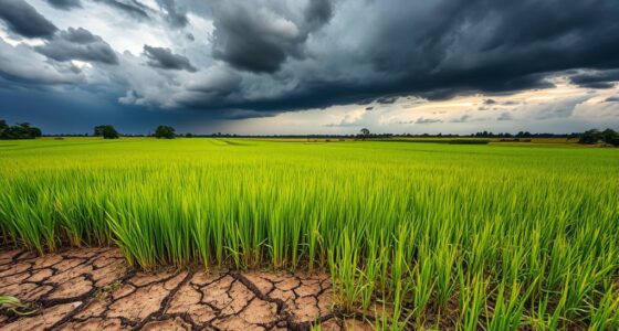
Furthermore, these tools enable you to fine-tune your crop choices based on forecasted climate conditions. For instance, if upcoming weather suggests drought stress, you might opt for drought-resistant varieties or adjust your irrigation strategy accordingly. Conversely, if high rainfall is predicted, you can prepare drainage systems or select crops that tolerate wetter conditions. This level of customization helps optimize your crop yield by aligning planting decisions with expected environmental factors, ultimately increasing your farm’s profitability.
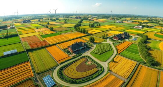
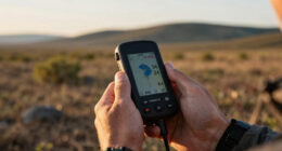
Satellite data adds a layer of spatial awareness to your planning process. You can monitor large-scale weather patterns and soil moisture levels across your entire farm, identifying areas that may require special attention. For example, satellite imagery can reveal waterlogged zones or drought-stricken patches, guiding you to target specific sections for irrigation or drainage improvements. This detailed insight allows you to allocate resources more efficiently, reducing waste and enhancing overall farm management. Additionally, understanding climate variability helps you develop more resilient farming strategies to adapt to changing environmental conditions.
AcuRite Digital Vertical Weather Forecaster, Reverse Color
Real-Time Weather Conditions: The stylish indoor weather station display, an indoor/outdoor thermometer, provides readings for indoor and outdoor…
As an affiliate, we earn on qualifying purchases.
As an affiliate, we earn on qualifying purchases.
Frequently Asked Questions
How Affordable Are These Ai-Driven Climate Tools for Small-Scale Farmers?
These AI-driven climate tools are becoming increasingly affordable for small-scale farmers, especially when you compare costs to traditional methods. While initial costs can pose affordability barriers, many providers offer low-cost or even free versions tailored for small farms. As technology advances, prices continue to drop, making these tools more accessible. Overall, with a cost comparison, you’ll find that integrating AI and satellite data is a smart investment that pays off in better crop management.
What Training Is Required for Farmers to Effectively Use These Tools?
You’ll need basic farmer education and digital literacy to effectively use these tools. Training sessions often include hands-on workshops, tutorials, and ongoing support to help you understand data interpretation and application. Many organizations provide user-friendly guides, and some tools are designed with intuitive interfaces, making it easier for you to integrate climate forecasts into your farming decisions. Building your digital skills guarantees you can maximize the benefits of these innovative technologies.
How Do These Tools Perform in Regions With Limited Satellite Data?
In regions with limited satellite data, these tools still achieve about 70% regional accuracy, but data scarcity can affect precision. You might notice less detailed forecasts, making it harder to plan effectively. To overcome this, AI models often incorporate alternative data sources like local weather stations. While satellite data scarcity presents challenges, ongoing advancements help improve forecast reliability, even in data-sparse areas.
Can These Tools Predict Sudden Weather Changes Accurately?
Yes, these tools can predict sudden weather changes, but their accuracy depends on the weather pattern and data reliability. When a weather pattern is complex or rapidly evolving, predictions might be less precise. You should be aware that limited or unreliable data can challenge the tools’ ability to forecast sudden shifts accurately. Always combine AI insights with local observations for the best decision-making.
What Are the Privacy Concerns Related to Satellite Data Collection?
It’s no coincidence that privacy concerns come up with satellite data collection. You might worry about data security and how your information is used. You need clear consent management practices in place to safeguard your rights. Satellites gather detailed data, so it’s essential that providers guarantee your privacy is maintained, giving you control over what’s shared and how it’s protected. That way, you can trust these tools without sacrificing your privacy.

YAMRON 4-in-1 Soil Moisture Meter, Digital Plant Temperature/Soil Moisture Test & PH Meter/Sunlight Intensity, Backlight LCD Display for Gardening, Farming and Outdoor Plants
【4 in 1 function】This is a 4-in-1 multifunctional soil tester.Our soil tester fastly to measure soil moisture, pH,…
As an affiliate, we earn on qualifying purchases.
As an affiliate, we earn on qualifying purchases.
Conclusion
Think of climate forecasting tools as your trusty compass on a stormy sea. They guide you through unpredictable weather, helping you steer your farm safely. With AI and satellite data as your seasoned navigators, you can avoid storms before they hit and reach calmer waters. Embrace these tools as your steadfast allies, turning uncertainty into opportunity. Together, you and technology can chart a course toward a more resilient, bountiful harvest.
pest prediction tool for agriculture
As an affiliate, we earn on qualifying purchases.
As an affiliate, we earn on qualifying purchases.

SunHaven Seeds Drought Tolerant Wildflower Mix – 20,000+ Seeds – 1 oz Bulk Extra Large Resealable Packet – Non-GMO Flower Seeds for Dry Climates – Black-Eyed Susan, Coreopsis, California Poppy & More
PREMIUM DROUGHT TOLERANT WILDFLOWER MIX: A carefully curated blend of hardy wildflowers selected to thrive in hot, dry,…
As an affiliate, we earn on qualifying purchases.
As an affiliate, we earn on qualifying purchases.